Friday, 20 November 2009

Hoover Dam – 13th November 2009

After the Grand Canyon the path of the Colorado River is again blocked by the Hoover Dam. Completed in 1935 it was for many years the worlds largest dam.

IMG_2655 IMG_2640The four towers direct water to the turbines which produce electricity. Traffic currently passes along the road on top of the dam.

A new bridge is being constructed over the canyon to allow traffic by-pass the dam (and reducing the risk of terrorist attack).

IMG_2646 IMG_2650 

The canyon is much narrower by this point and steep mountains are all around the dam location.

IMG_2660


Looking downstream from the top of the dam.


 IMG_2665

Looking back at the dam from the Nevada side with the visitor centre car park in the foreground.


Lake Mead was created by the dam being built and it is about 70ft below its normal level as shown by the white line on the rocks.


IMG_2668

Although the dams (at Lake Powell and the Hoover) produce large amounts of hydro electric power, their main purpose is to regulate the flow of water in the Colorado River providing a means of managing supplies to the south western states whilst controlling floods from rain and spring melt waters.

The Grand Canyon – 8th to 11th November 2009

From Lake Powell the Colorado River flows through Marble Canyon and into the Grand Canyon National Park. Around 40 miles of the canyon is easily accessible from paved roads in the National Park, although the Canyon is some 270 river miles long (about 140 linear miles). The size is difficult to comprehend from the pictures alone, so a few more words than usual are required.

IMG_2442

From the east the river meanders through the wide valley (average width is 10 miles and the river is 300ft wide).

IMG_2497

A major feature of the Canyon is the depth (average 6,000 ft – over a mile). The river has cut down through numerous layers of rock over tens of thousands of years and distinct layers are visible with dark granite like rock in the layer at the base.

Before the Lake Powell Dam was built an estimated 86 million tons of sand and stone was carried through the canyon each year, cutting deeper as it went. These solids are now retained in Lake Powell which will become completely clogged in between 100 and 300 years.

IMG_2515

The light coloured band on the far side of the canyon is about 600 ft below the cliff top. In many areas the cliff top is not protected and there is a steep 300ft drop.


The iron oxide rich red rock layers come to life at sunset in a vivid red-orange display. Again the camera proves inadequate to capture the full view.

  IMG_2524 IMG_2526 IMG_2527

The north rim of the valley as shown is more heavily eroded than the south where the main access routes are to be found.  Again the red rock starts about 600ft below the cliff top and in the picture below the bottom 1,000 ft cannot be seen.IMG_2549

IMG_2563

Looking down into the valley is what you do most of the time. If you are very fit an over night hike to the bottom and back is possible.

IMG_2590 

Look very carefully at the picture above and, on top of the rocks in the centre of the picture, you will see four people standing behind a rail.

IMG_2591

That same piece of rock is now in the top right corner of this picture.


The first cliff is about 300ft.


The walkers are on a trial near the top of the next 300ft cliff face.


 IMG_2592


To get a better feel for the scale of the canyon we went for a walk “under the rim” on the Bright Angel trail.


IMG_2600


After an hour we had descended 600ft to the red rock layer and walked about 2.5 miles.


The trial continued over 10 miles further and another 4,000ft down.


After 3 days around and in the canyon we had taken a glimpse of a small section of it and were just beginning to understand just how big it really is….

VERY BIG INDEED!

Wednesday, 11 November 2009

Airborne in Arizona

Purely by chance we came across the Page Balloon Regatta and on Friday 6th November 2009 we were lucky enough to be picked as volunteer crew for Kaleidoscope.

Page 091107 (7)Over the next 3 days we helped with the balloon.

From unpacking the “envelope”  and laying it out on the ground.


Page 091107 (15)


Initial inflation with a large fan.


Page 091107 (31)


Followed by heating the air with huge flames blasting from the liquid propane burners.


P1030302


Elaine in the basket with Pilot George, local news reporter Mary and Georges wife Aggie standing alongside.


IMG_2385   IMG_2402

We were please to be able to help with the Saturday night “Glow” event, a real crowd puller.

IMG_2306 

Balloons over the Colorado River canyon downstream fro the Lake Powell Dam.


Page 091107 (66)-1

The business end. The burner heats the air  to over 80 deg C  providing the lift


Page 091107 (84)

We enjoyed being members of the chase team trying to get into position for the landing.


Page 091107 (90) 

Once on the ground the balloon has to be deflated.


Page 091107 (101)


Carefully packed into the carry sack…..


Page 091107 (105)


……..which is compacted by a few heavy weights ready for loading into the trailer…….


Page 091107 (107)


…..and lastly the tarpaulins are rolled ready for next time.


Thanks to George and Aggie who own the balloon, Jim and Sandy their long term crew members, our new friends Lawrie and Monica who joined the team on day 2 and the sponsors who gave us a very memorable weekend.

Tuesday, 27 October 2009

Days out from Manitou

Holed up in Manitou Springs waiting for RV parts to arrive we hired a car and explored some of the old roads that have been taken over by the Forestry service.

Gold Camp Road

This follows the old rail route from the gold fields of Victor and Cripple Creek to Colorado Springs. The photo is straight the tunnel ‘aint.

clip_image001

Due to several collapsed tunnels part of the road is closed and the Old Stage Road has to be used. About 40 miles and 2 hours later we arrived at Victor.

clip_image002

Three star gazers along the route.

clip_image003clip_image004

Dis-used gold mines at Victor. There were over 500 mines in the 1890’s.

clip_image005A number of establishments sprang up to serve the population of 18,000.
 

clip_image006


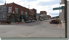
Now the population is around 400 and the main street is all but deserted.

 

clip_image008

clip_image007One of the only businesses we found that was open. Karen has been hand making brooms for over 20 years and her husband runs the local printing press.

clip_image011

Spectacular views of the distance mountains over the nearby hills reward the few visitors to Victor at this time of year.

Phantom Canyon Road

Another old railroad track converted into a road; the Phantom Canyon Road runs from Florence in the south up the valley to Victor and Cripple creek.

 clip_image009

The first 10 miles or so were tame.


clip_image012

Then the road narrowed and the rocks grew higher, but much easier road than the previous day.


Pikes Peak Toll Road

In 19 miles the road climbs around 7,000 ft up to the summit of Pikes Peak, at 14,110ft it is one of the 50 or so “Fourteeners”.

T-shirt weather at the start is replaced by sub-zero temperatures at the top fanned by a strong wind.clip_image010

  Views to other distant peak in the Rockies range.clip_image013

Summer events include hill climb races and a marathon up the foot trail. The record time to run up the 13 mile trail with 7, 000ft of elevation increase and back down again was a little over an amazing 3 hours. We were feeling the effects of altitude just slowly strolling around the top.

Idaho Springs

Before going to Manitou Springs we were staying further north at Idaho Springs. A 20 min walk took us to town where we found the “Tommyknockers Brewpub”. All very friendly; the food was good, the beers had very fruity flavours and the wall paintings interesting.

clip_image014clip_image016clip_image017

A Tommyknocker was a being who lived in the Cornish tin mines, and guided the miners to tin finds or away from danger by making tapping sounds on the walls. The brewery founder claims the tapping sounds he heard guided him to set up the enterprise and gave him inspiration for the recipes of his first brews and hence the name was adopted. The walls of the pub are painted with appropriate scenes of brewing and mining……………. clip_image015


and it would have been rude not to have sampled some of the results.

Thursday, 8 October 2009

Into Colarado

We entered Colorado south of Laramie, WY and were in North State Park. We had little info but found that we had stumbled upon "Moose Central" in Colorado.
This is a sculpture made from barbed wire at the visitor centre in Gould.

We had hoped to see a Moose at Yellowstone.................. but true to form they were hiding from the camera.


Then this large bull just ambled out across the road in front of us and wandered off in the willow shrub (its favourite food).


We headed for Fort Collins along HW16 following the Poudre River most of the way.


One of several canyons along the way.